Answer the question
In order to leave comments, you need to log in
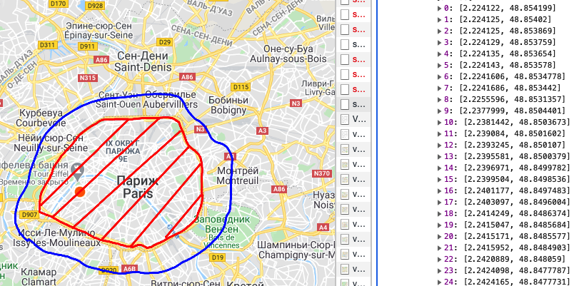
How to increase the radius of country polygons on the map?
I'm using api nominatim to search the map. This api returns an array with the polygons of the features on the map.
For example, if I enter Paris in the search, I will get the result:

And I am already working with these coordinates.
Question:
How can this range be increased by 50 km, for example?
So that as a result I get a list of polygons in the same form.
Answer the question
In order to leave comments, you need to log in
Didn't find what you were looking for?
Ask your questionAsk a Question
731 491 924 answers to any question