Answer the question
In order to leave comments, you need to log in
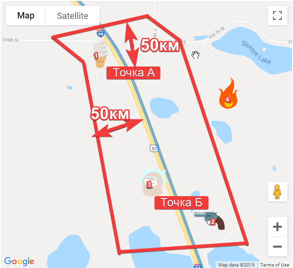
How to display all "places" within a radius of 50 km from the road from point A to point B?
There is a map where the user leads the initial, intermediate (if necessary) and the end point. Next, the path is shown to him.
Like this example.
There is also a JSON file that stores places of this format -
{
      "location": {
        "latitude": -78.46545693840129,
        "longitude": 545.125644880189
      },
      "placeId": "id001"
    },
Answer the question
In order to leave comments, you need to log in
1. Take your points and enter them into a spatial database, build an index by geometry. All major DBMS have such extensions.
2. Get a route from Google and transfer it to your server.
3. There, build a buffer around it and get your desired points, give them to the client.
4. Profit.
Didn't find what you were looking for?
Ask your questionAsk a Question
731 491 924 answers to any question