Answer the question
In order to leave comments, you need to log in
How to localize a set of panoramas with point mapping?
Good afternoon,
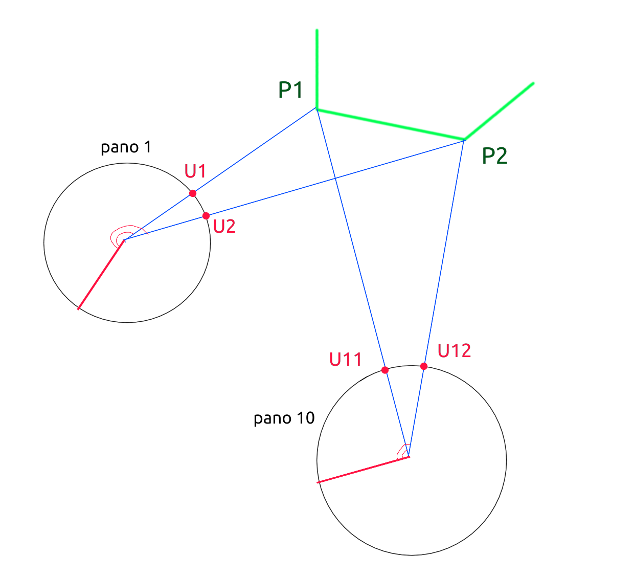
There is a set of ~10 equirectangular panoramas (ala streetview). For each panorama, I found 10 points that were "smapped" with other panoramas from the set...those are pano 1-> point U1,V1 = pano2-> point U11,V11 , where U,V are coordinates on a particular panorama.
Required: find the position and orientation of each panorama in a single 3D space.
I found the OpenVSLAM framework, but it is geared towards working with video and automatically detecting features using ORB. It doesn't suit me because the panoramas from the set were made at different times of the year, lighting, etc... that's why it's necessary to use the result of manual mapping.
Thank you.
PS Illustration of the 2D version. Known U1,U2, U11,U12 - you can calculate their angles from an arbitrary direction for each panorama
Answer the question
In order to leave comments, you need to log in
Didn't find what you were looking for?
Ask your questionAsk a Question
731 491 924 answers to any question