Answer the question
In order to leave comments, you need to log in
What algorithms are used to filter GPS coordinates?
According to the results of observations, even on an absolutely motionless device, the "coordinates" run and jump like God puts it on the soul :) Therefore, the question arose what algorithms / methods are used to filter GPS coordinates?
Answer the question
In order to leave comments, you need to log in
Here are graphs of latitude and longitude and below delta (distance) in meters.
The funny thing is that at the beginning of the first time, the GPS coordinates do not change at all, but then wandering begins. All this time the phone stood by the window absolutely motionless.
An interesting moment, when both coordinates jump for the first time on the first graph, then there is no change on the delta (distance) graph, i.e. In some strange way, despite the jump, the phone is still motionless.
After reading similar topics and about the Kalman filter, there was a suspicion that the GPS sensor already uses it anyway, is this true?
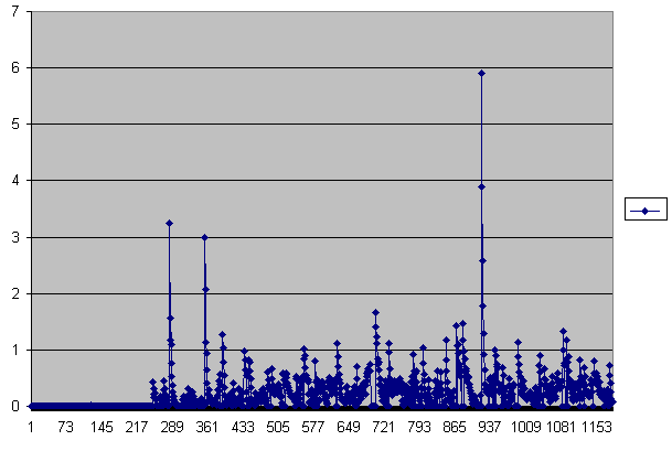
And here is a new distance graph obtained as follows: we get the latitude and longitude of the GPS, calculate the x,y,z coordinates, drive each coordinate into our own Kalman filter. As a result, the picture turns out to be much better, the maximum spread is about 6 instead of 10, but again, there was a fly in the ointment: a significant surge appeared on that very initial section, followed by a plume.
I came up with the idea to calculate the coordinates in two versions at once with and without a filter and take the smallest of them, as a result, the picture became even better, although this is for a static mode, but it’s hard to say how it will behave in motion :)
Didn't find what you were looking for?
Ask your questionAsk a Question
731 491 924 answers to any question