Answer the question
In order to leave comments, you need to log in
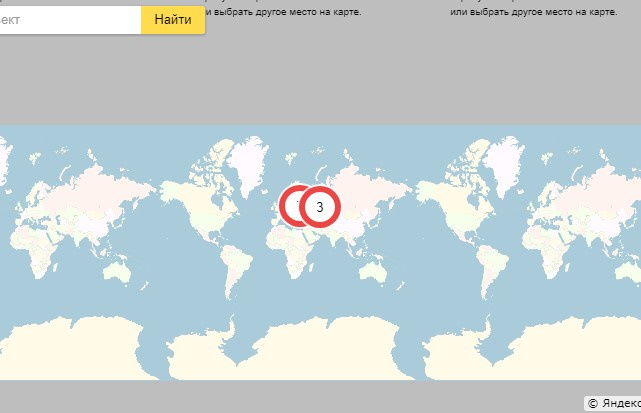
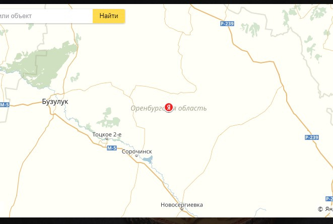
How to set the zoom factor after determining the location?
ymaps.ready(init);

function init () {
    var myMap = new ymaps.Map('YMapsID', {
        center: [55.76, 37.64],
        zoom: 8,
        controls: ['geolocationControl', 'zoomControl', 'searchControl']
    }, {
        searchControlProvider: 'yandex#search'
    }),

    objectManager = new ymaps.ObjectManager({
            // Чтобы метки начали кластеризоваться, выставляем опцию.
            clusterize: true,
            // ObjectManager принимает те же опции, что и кластеризатор.
            gridSize: 32,
            clusterDisableClickZoom: true
        });

    // Чтобы задать опции одиночным объектам и кластерам,
    // обратимся к дочерним коллекциям ObjectManager.
    objectManager.objects.options.set('preset', 'islands#redDotIcon');
    objectManager.clusters.options.set('preset', 'islands#redClusterIcons');
    myMap.geoObjects.add(objectManager),

    $.ajax({
        url: "wp-content/themes/urbech-style/data.json"
    }).done(function(data) {
        objectManager.add(data);
    }),


    ymaps.geolocation.get({
    // Выставляем опцию для определения положения по ip
    provider: 'auto',
    // Карта автоматически отцентрируется по положению пользователя.
    mapStateAutoApply: true
    }).then(function (result) {
    myMap.geoObjects.add(result.geoObjects);
    });
}
Answer the question
In order to leave comments, you need to log in
Didn't find what you were looking for?
Ask your questionAsk a Question
731 491 924 answers to any question