Answer the question
In order to leave comments, you need to log in
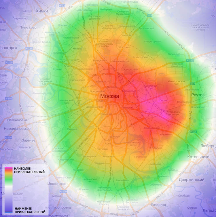
Create a heat map of the time it takes to get to a point?
Subject:
Looking for an apartment to rent. It is required that the road from the apartment to work was <= 30 minutes. You need to find all the points on the map that meet this condition, I plan to get there by public transport.
As the time before work decreases, the color of the area (point) on the map also changes. In fact, you need to calculate the distance to the specified point for all other points.
I plan to take Yadnex or Google maps as a source.
Where to begin?
Yes, can it be implemented in a short period of time and without material costs?
Answer the question
In order to leave comments, you need to log in
Run through all points of the map. For each iteration, make a request to the Maps API, getting the travel time to your work. Then convert that time to a color (eg brightness=minutes). Then draw the map and recolor it. Save the new image.
Didn't find what you were looking for?
Ask your questionAsk a Question
731 491 924 answers to any question